Posts with tag 'Outdoors'
Subscribe and receive email notifications of new blog posts.
 RSS Feed
- 2026 | 2 Posts
- 2025 | 4 Posts
- 2024 | 23 Posts
- 2023 | 14 Posts
- 2022 | 76 Posts
- 2021 | 78 Posts
- 2020 | 64 Posts
- 2019 | 91 Posts
- 2018 | 93 Posts
- 2017 | 107 Posts
8
Northeast Ohio: Stark County Is a Walk in the Park

Are you feeling cooped up at home and need a bit of fresh air? Take advantage of Stark County's beautiful outdoor spaces and go for a relaxing walk. We're surrounded by picturesque trails that offer unspoiled areas where we can clear our heads and forget about life for a while. Spend a few hours strolling these Northeast Ohio walking trails and parks.
West Branch Trail
1305 Stadium Park Dr. NW, Canton, OH 44708
View this post on Instagram
The West Branch Trail, running along the West Branch of the Nimishillen Creek, is a fantastic trail to walk if you want to get up close and personal with a few Stark County landmarks. This trail is just under four-and-a-half miles long and connects to seven parks, including what once was Mother Goose Land and Covered Bridge Park. Great for running, biking, hiking, or walking your dog the West Branch Trail
Congressman Ralph Regula Towpath Trail Park
Lake Lucerne Trailhead, 7975 Erie Ave. NW, Canal Fulton, OH 44614
View this post on Instagram
While you may not want to walk the full 25 miles of the Ohio and Erie Canal Towpath Trail, you can explore the Congressman Ralph Regula trail at one of 14 trailheads. We suggest taking on the Canal Fulton northern section at the Lake Lucerne Trailhead. This trailhead offers a convenient place to park and walk then cast a line when your return.
Devonshire Park and Trail
4679 South Blvd. NW, Canton, OH 44718
Get off of the beaten path and get close to wildlife at the Devonshire Park and Trail. This trail extends only a little longer than a half of a mile and runs on mowed grass to offer an easy opportunity for wildlife viewing and birdwatching. Fishing is also permitted at this park, but these conservation lands are also great for children to enjoy with their parents.
Hoover Trail
Hoover Community Recreational Complex, 1325 E. Maple St., North Canton, OH 44720
View this post on Instagram
Although the recreation complexes may be unavailable, you can still find plenty of space to roam on the Hoover Trail. Park at the Hoover Community Recreational Complex and walk along the 5-mile trail that connects with other areas of the Hoover District. Animal sightings are common along this trail during all seasons, so be sure to take it slow and keep your eyes open!
Mahoning Valley Trail
Deer Creek Reservoir, 14514 Price St. NE, Alliance, OH 44601
View this post on Instagram
If you've ever wanted to get a closer look at the Mahoning River, head over to the Mahoning Valley Trail. You can start your hike on this scenic trail at the Deer Creek Reservoir and enjoy a 4-mile walk over boardwalks, bridges, and along the Mahoning River. There are a few picnic areas around the trailhead as well where you can have lunch as well.
Nickel Plate Trail
2923 Pinevale Ave. NE, Louisville, OH 44641
The Nickel Plate Trail is a great mix of urban and rural landscapes. Stretching four miles with its recently added section, most of this trail is unpaved gravel or unimproved natural surface, making it a little more of a challenge than a typical stroll would entail. There are often horses on the trail, and with private property surrounding much of the area, it's best to remain on the trail and stay visible to other passersby.
Pioneer Trail
2600 Harvard Ave. NW, Canton, OH 44709
Another small trail in the Canton area, the Pioneer Trail is just over one-mile long and takes hikers towards the campus of Malone University. Unlike some of the flatter trails of the area, the Pioneer Trail features inclines and declines throughout, making it a good trail for runners, more active hikers, and bikers.
Sandy Valley Trail and Waynesburg Park Loop Trail
262 Maple St., Waynesburg, OH 44688
View this post on Instagram
For those who would like to get a few laps in, the Waynesburg Park Loop Trail is perfect. Short and sweet, this trail circles the park. You can add three-quarters-of-a-mile to your exercise by walking the Sandy Valley Trail.
Sippo Valley Trail
2069 Skyland Ave. NW, Massillon, OH 44647
View this post on Instagram
A much longer trail that connects to the Towpath Trail, the Sippo Valley Trail stretches ten miles. It begins as an asphalt trail but does transition to limestone farther down. You'll walk parallel to Sippo Creek, and most of the trail is relatively flat, offering a simple but long trek between the trailheads.
Iron Horse Trail
1141 W. Beech St., Alliance, OH 44601
View this post on Instagram
Once a railroad right-of-way, the Iron Horse Trail now offers four-and-a-half miles of biking and hiking space for people and their pets. With a trailhead at the First Christian Church and an adjacent neighborhood, the Iron Horse Trail is convenient for Alliance families to access.
Cook's Lagoon and Trail
1819 Mahoning Road NE, Canton, OH 44705
Cook's Lagoon is a popular fishing hole, but it's a nice walking trail with benches and an easy walk for those who want to stroll at their own pace.
Molly Stark Park
7900 Columbus Rd. NE, Louisville, OH 44641
View this post on Instagram
Get your fill of trails at Molly Stark Park. In the process of becoming a 35-acre park with hiking trails, gardens, and plenty of outdoor space to explore, Molly Stark Park is a great place to find fresh air close to home. Be sure to research the history and mysteries of the Molly Stark Park building to understand why it was a significant hospital for the treatment of Tuberculosis.
Social Distancing in Serene Surroundings
Where do you love to get away and embrace a nature hike? Tell us in the comments below.
20
Explore These Bike Trails Around Columbus
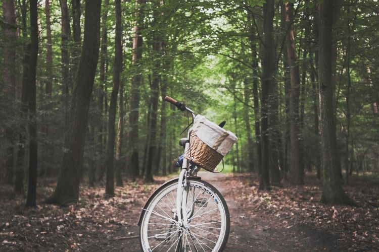
When you need a breath of fresh air far from the city crowds, you'll find ample space to roam in Columbus. With many miles of bike paths and trails, our city has a lot to offer for anyone who loves the great outdoors.
Columbus is also a major hub for state-wide trails and greenways, some of which stretch for hundreds of miles across the Buckeye State. These bike paths in the Columbus area offer ample opportunities to get outside, get in shape, and simply enjoy the greener side of Central Ohio.
Alum Creek Trail
Three Creeks Metro Park, 3860 Bixby Road, Groveport, OH 43125
View this post on Instagram
A favorite multi-use trail that stretches roughly 25 miles across Franklin County, the Alum Creek Trail offers a well-maintained hard surface for hikers and cyclists. The trail follows the picturesque Columbus river corridor, from Westerville to Three Creeks Park, passing through several parks and neighborhoods along the way. Construction on the trail was completed in 2015, and the Alum Creek Trail has quickly become the go-to destination for Columbus residents looking to get outside.
Olentangy Trail
Whetstone Park, 3901 N. High St., Columbus, OH 43210
View this post on Instagram
The Olentangy Trail is a great place to go for a bike ride, but for many first-time visitors to Columbus, its central location makes it one of the most popular ways to explore the city on foot. The trail connects the community of Worthington to downtown Columbus, meandering through several neighborhoods along the banks of the Olentangy River. Along the way, the Olentangy Trail passes through the Ohio State University campus, with trailheads at Whetstone Park as well as several other major city parks.
Scioto Trail
Scioto Trail Park, 2951 S. High St. Columbus, OH 43207
View this post on Instagram
The first greenway ever built in Columbus, the Scioto Trail has been a treasured resource for hikers and cyclists in the city since 1976. It's still a favorite local bike path, with sections on either side of the Scioto River, including the downtown riverfront, where you can get a great view of the Columbus skyline. The most well-known section of the path is the Scioto Mile, which includes a string of prominent parks, promenades, and landmarks. Near the south edge of Downtown Columbus, the trail traverses the beautiful Scioto Audubon Park, including a trailhead at the Audubon Nature Center. The Scioto Trail also directly connects to the Olentangy Trail.
Heritage Trail
7262 Hayden Run Road, Hilliard, OH 43026
Following an old abandoned rail line from Old Hilliard to Cemetery Pike, the Heritage Trail one of the less-used bike paths in the Columbus area. That makes it a great place to beat the crowds, although the Heritage Dog Park at one end of the trail does make it a popular spot for dog walking. Paved, well maintained, and easy to follow, it's a great place for an afternoon bike ride, passing through about 7 miles of fields and farmlands just outside Columbus.
Blacklick Creek Greenway
Three Creeks Metropark, 3860 Bixby Road, Groveport, OH 43125
View this post on Instagram
Running parallel to its namesake creek for most of its 18-mile length, the Blacklick Creek Greenway stretches from Reynoldsburg to Groveport on the southeastern edge of Columbus. There are several parks and trails in the Columbus area where you can hop on the Blacklick Creek Greenway, but a favorite spot is Three Creeks Metro Park. This park marks the spot where the Alum, Big Walnut, and Blacklick creeks join; and it's also home to sections of both the Blacklick Creek Greenway and the Alum Creek Greenway.
Chestnut Ridge Mountain Bike Trail
Chestnut Ridge Metro Park, 8445 Winchester Road NW, Carroll, OH 43112
View this post on Instagram
While many of Columbus' bike paths are great for easy rambles along relatively flat, paved trailways, the mountain bike trail at Chestnut Ridge Metro Park offers something a little more extreme. Just a few miles southeast of Columbus, Chestnut Ridge is actually the first ridge of the Appalachian Mountains, and the Chestnut Ridge Mountain Bike Trail is a great place for an intense mountain biking experience. The trail runs a little over 9 miles through deep woods, with many steep climbs and descents, along with a few bridges and some steep, banked turns. The trail is divided into two loops, one for beginner to intermediate mountain bikers, and the other for experienced cyclists only.
Big Walnut Trail
Inniswood Metro Gardens, 940 S. Hempstead Road, Westerville, OH 43081
View this post on Instagram
The Big Walnut Trail stretches a little over 10 miles through several Columbus area parks, including Inniswood Metro Gardens, a lovely botanical garden and nature preserve that's open free of charge seven days a week to the general public. Popular for jogging and dog walking as well as biking, the Big Walnut Trail is a paved multi-use trail that also offers expansive views of Hoover Reservoir and the parks along the lakeshore.
Camp Chase Trail
Battelle Darby Creek Metropark, 1775 Darby Creek Dr, Galloway, OH 43119
View this post on Instagram
Just over 16 miles long, the Camp Chase trail runs between the cities of London and Columbus, acting as a connector between Madison and Franklin counties. The trail is relatively level and easy for biking, consisting of paved double-track that follows the course of a railroad line. In addition to being a great biking spot for Columbus residents, the Camp Chase Trail is also a crucial link in the much longer Ohio to Erie Trail, which stretches 326 miles across the state of Ohio from southwest to northeast.
Hit the Trails
Did we forget to mention your favorite trail? Be sure to let us know in the comments section!
4
Cleveland: Where to Train for Your Next 5K

Lace-up your running shoes and fill up your water bottle — it's time to train for your next race! As the warm weather slides into Northeast Ohio, the many trails and pathways around the region are shaking off their snow and inviting runners to go the extra mile in preparation for 5Ks, 10Ks, and marathon races! Even if you're not training to beat your record time, frequent running will keep your form consistent and help you complete each race you enter. Check out these trails located in a few of our favorite green spaces around the Cleveland area.
Big Creek Reservation
4101 Fulton Parkway, Cleveland, OH 44144
View this post on Instagram
The fishing, sledding, and picnicking at Big Creek Reservation are all enjoyable, but the gem of the park has to be the gorgeous Lake to Lake Trail. Connecting Lake Isaac to Lake Abram, this 2.4-mile all-purpose trail crosses through the wetlands and provides a steady pathway for runners entering into their first race to gain their footing.
Punderson State Park
11755 Kinsman Road, Newbury, OH 44065
View this post on Instagram
Just a short drive from downtown Cleveland is Punderson State Park. While others boat on Punderson Lake or play golf, you can take advantage of nearly 11 miles of trail. Of the eight trails in the park, the farthest is 2.2 miles, while the shortest is a simple 0.1 mile — most hover been 0.75 and 1.2 miles. With such easy and accessible trails available, this is a great place to get a quick run in before you enjoy the park's other amazing amenities.
North Chagrin Reservation
Cleveland Metro Park Drive, Mayfield Village, OH 44143
View this post on Instagram
The North Chagrin Reservation is a fantastic place for runners who love adventure. Within the reservation is Foster's Run, a stunning trail that connects a newly constructed all-purpose trail with an old roadway. Although this trail connects the Wilson Mills Road Trailhead parking lot with the Forest Picnic Area, you can choose to jump on the Buckeye Trail or Bridle Trail to extend your run. There's also a physical fitness trail on the reservation that offers additional opportunities to exercise.
Acacia Reservation
26899 Cedar Road, Lyndhurst, OH 44124
View this post on Instagram
Looking for a place to run with nature while doing so on a paved path? Acacia Reservation sounds like the spot for you. Their 1.7-mile paved loop trail offers an opportunity to tackle a manageable run or work on your stamina with multiple laps.
Springfield Bog Metro Park
1400 Portage Line Road, Akron, OH 44312
View this post on Instagram
The Springfield Bog Metro Park is home to the Prairie Trail, an easy 1.6-mile jaunt that leads runners through a gorgeous prairie. This park is less than a decade old and was once unused farmland. As you run, you'll see more than 40 species of plant wave to you as this beautiful new boggy area continues to thrive.
Cuyahoga Valley National Park
15610 Vaughn Road, Brecksville, OH 44141
View this post on Instagram
The parks and reservations above offer fantastic trails that will surely help you get in shape for your 5K, but we've saved our top pick for last — Cuyahoga Valley National Park. This massive park connecting Akron and Cleveland offers up over 125 miles worth of hiking trail for you to break in your running shoes and set your sights on breaking every goal you set. With so many trails to choose from, you'll have plenty of opportunities to get to know this park inside and out. Here are a few of the trails we suggest you conquer in each area of the Cuyahoga Valley National Park.
Kendall Lake Area Trails
The trails in the Kendall Lake Area are practically built for runners who want to gradually increase their goals. We like to think of them as perfect markers to help track our progress. The Lake Trail is an easy one-mile trail while the Cross Country Trail is a little more challenging at 2.5 miles. Did you guess that the third trail, the Salt Run Trail, was 3.3 miles and the most challenging? Master each one individually, then combine them to really test your limits!
Ledges Area Trails
Here are two sets of trails for two types of runners. Those who are shaking off the rust or are running for their first time will love the easy Forest Point Trail and Haskell Run. Both are only half-of-a-mile long and hardly have an elevation change. The other two trails, Ledges Trail and Pine Grove Trail are each 2.2 miles long and offer a moderate challenge. We love running the longer trails for endurance and hitting the shorter trailers hard for an explosive final sprint to the finish!
Cuyahoga Valley Trails
The Cuyahoga Valley Trails tackle three areas of the park from Station Road to Boston to Everett. Their four loop trails have the following distances: Station Road Bridge to Red Lock 10.3 miles, Red Lock to Boston 8.1 miles, Boston to Peninsula 7.4 miles, and Peninsula to Hunt Farm 9.4 miles. While trekking through these areas, you'll use different pathways including the statewide Buckeye Trail, the Valley Trail, and Towpath Trail. These runs can be quite tiresome, especially if you're still getting into the groove of long-distance running. Thankfully, there are many parking lots lining the trails, which allow you to carve out small sections of them and gradually increase your out-and-back distance when you're comfortable.
Oak Hill and Plateau Trails
If you follow Oak Hill Road north just past the Cuyahoga Valley Environment Education Center, you'll be able to access the Oak Hill Trail and the Plateau Trail. Both trails are loops, with the Oak Hill Trail labeled an easy trail at 1.8 miles and the Plateau Trail stretching just under 5 miles, with a moderate to difficult ranking. Either trail alone offers a solid run; however, what we like most about this duo is the Oak Hill Trail connects to the Plateau Trail at six spots. If 5 miles is too much yet 2 miles is too little, you can break off of the Oak Hill trail, run through sections of the Plateau Trail, then jump back on the Oak Trail to finish. This allows you to make the Oak Hill Trail stretch as far as you desire.
Wetmore Area Trails
The Wetmore Area Trails are quite scenic, so much so that when we aren't training for a race, we love to take the slow route via horseback. You can access five trails from the Hunt House right on Bolanz Road — Wetmore Trail, Butler's Trail, Langes Run Trail, Tabletop Trail, and Valley Trail. Butler's Trail is a quick and easy 0.6-mile out-and-back trail while the Tabletop Trail is a little longer at 0.75 mile that acts as a short cut through the Wetmore Trail. The Wetmore Trail and Langes Trail are longer, at 4.5 miles and 3.5 miles respectively, and offer a moderate to difficult run. However, we suggest that marathon runners set their sights on the 19-mile Valley Trail. It's quite a trek, but uninterrupted paths with ranging levels of difficulty offer a chance to really test your strength and stamina.
On Track
Where are your favorite places to run free around Cleveland? Let us know in the comments below!
25
9 Outdoor Clubs to Meet Like-Minded People in the Akron & Canton Area
2
An Insider's Guide to Hiking in Cuyahoga Valley National Park


The Cutler Real Estate® word mark is a registered trademark owned by Cutler and Associates, Inc.
Privacy Policy / DMCA Notice / ADA Accessibility